

One of the main aims of the project is to give ordinary people access to international research and information around Partition and its use around the world as a solution to conflict. One way we have found which helps make this connection is data visualisation. When we can see facts and patterns illustrated they are often better understood. One great example of data visualisation has been pioneered by Max Galka on his Metrocosm blog site.
He writes:
Some of the biggest geopolitical events in the world are centered around disputed territories, land whose sovereignty is claimed by more than one nation / occupying power.
At the other extreme, some territorial disputes involve land that would seem entirely worthless. The U.K., Iceland, and Denmark all assert ownership of Rockall Island, an 8,000 square foot rock in the middle of the North Atlantic, hundreds of miles from the nearest inhabited location.
From one extreme to the other, at least 124 countries (or “would-be” countries) are involved in a territorial dispute of some kind, involving, by my count, 105 separate territories.
- Scroll down to read about some of the world’s more peculiar disputed territories.
- Or to explore all 105 of the world’s disputed territories, click the link below to view the interactive map.
>>>>>> View Interactive Map of Disputed Territories

6 of the most interesting / surprising / bizarre territorial disputes
Behind the conflicts are some strange and fascinating stories. Here are a few that caught my attention.
The Kuril Islands: The reason Japan and Russia still haven’t signed a peace treaty to end World War II
 The Kurils are a string of islands stretching from the north of Japan to the southern tip of Russia‘s Kamchatka Peninsula. Because of a ongoing dispute over the islands’ sovereignty, Japan and Russia still haven’t signed a peace treaty to end World War II.
Prior to WWII, the situation was clear. Japan owned the four southern islands and the Soviet Union owned everything else. During the war, the Soviets invaded Japan, annexed the islands, and have controlled them ever since.
- Russia’s claim: In the San Francisco Peace Treaty, which Japan signed in 1951, Japan agreed to give up all claims to the Kuril Islands, making Russia the rightful owner.
- Japan’s claim: The Soviet Union never signed the San Francisco Peace Treaty, so Russia’s claims are void. Additionally, the Treaty does not specify which islands the Kuril Islands include. And Japan claims that some of the disputed islands are not actually part of the Kurils.
Because they have yet to settle their dispute over the Kuril Islands, Japan and Russia have not yet signed a WWII peace treaty, and are technically still at war.
Related fact: The U.S.S.R. didn’t actually declare war on Japan until August of 1945, a month before the Japanese surrender, and after the U.S. had already dropped the atomic bomb on Hiroshima.
Belize: Is there a Belize?
 Since 1940, Guatemala has, in whole or in part, claimed sovereignty over its neighbor Belize.
The foundations of this territorial dispute date back to 1821, when Guatemala declared its independence from Spain. At the time, Spain (and Guatemala) considered Belize to be part of Guatemala. However, it was occupied and controlled by English settlers, so its status was unclear.
- The U.K.’s claim: In 1859, Guatemala signed a treaty with the U.K., in which it agreed to recognize Belize as a sovereign nation in exchange for economic assistance.
- Guatemala’s claim: The U.K. never complied with the promised economic assistance, so the treaty is void.
- Belize’s claim: It doesn’t matter whether the U.K. complied or not. Belize didn’t sign the agreement. And it cannot be forced to give up its land based on an agreement that it never signed.

The Strait of Gibraltar: Spain controls the side attached to Morocco, but not the side attached to Spain
 On the southern side of the Strait is Ceuta, an overseas Spanish city whose sovereignty is disputed by Morocco. On the northern side is Gibraltar, a British overseas territory whose sovereignty is disputed by Spain.
- The U.K.’s claim (Gibraltar): Spain ceded Gibraltar to the U.K. in 1713 under the Treaty of Utrecht. And the Gibraltarians themselves are overwhelmingly opposed to Gibraltar being placed under Spanish control.
- Spain’s claim (Gibraltar): U.K. sovereignty over Gibraltar violates Spain’s right to territorial integrity.
- Spain’s claim (Ceuta): Portugal ceded Ceuta to Spain in 1668 under the Treaty of Lisbon. And the local population is overwhelmingly opposed to Ceuta being placed under Moroccan control.
- Morocco’s claim (Ceuta): Ceuta (and other overseas Spanish territories) should be returned to Morocco so that Morocco may maintain its “territorial integrity.”
According to Spain, the two disputes are actually quite different. Whereas Gibraltar is administered by the Gibraltarians, and is not considered part of the U.K., Ceuta is and always has been “an integral part of Spain,” with elected representatives in the federal government.
Rockall Island: Why are three countries fighting over a tiny rock in the middle of the nowhere?

As mentioned at the top of the post, Rockall Island is an uninhabited rock in the middle of the North Atlantic, hundreds of miles from the nearest human settlement. The size of Rockall is only about 8,000 sq ft, roughly 10x the size of my tiny Manhattan apartment. Yet, the U.K., Iceland, and Denmark(Greenland) have been fighting over it for over 200 years.
And Rockall is not the only example of what would seem a pointless territorial dispute.
Canada and Denmark (Greenland) both claim sovereignty over Hans Island, a barren rock measuring only half a square mile in size, located near the northern boundaries of Canada and Greenland.
Colombia, Jamaica, Nicaragua, and the U.S. all assert ownership of Bajo Nuevo Bank, a tiny, uninhabited reef in the remote Western Caribbean, about 150 miles from the nearest permanently inhabited land feature.
Why are so many countries fighting over territory that would seem so worthless?
The answer has less to do with the territories themselves than it does with ocean resources. Based on the United Nations Law of the Sea, ownership of remote territories such as these allows countries to stake claim to the fishing, navigation lanes, and oil deposits in the surrounding area.

Arunachal Pradesh: Google Maps’ borders differ depending on who’s looking at them
 Arunachal Pradesh is internationally recognized as a state of India, and it has been since its borders were agreed to in the 1914 Simla Accord. China was among the countries in attendance, however it ultimately rejected the Accord. And to this day, China recognizes the region as South Tibet, part of its own territory.
I include this dispute not because the conflict itself is particularly novel, but because, as pointed out in this post from last year’s Knight-Mozilla-MIT hackday, it is an example of how the borders shown by Google Maps can differ depending on who’s looking at them.
China also requires that Google Maps apply a form of geographic encryption to its territory, causing everything in China to appear slightly offset from its true location. This strange Chinese coordinate system, known as GCJ-02 (sometimes called”Mars coordinates”), even causes some geographic features to disappear entirely from the map. Case in point, note the disappearing river in the image below.
The image below shows borders of Arunachal Pradesh according to Google Maps in China, India, and the U.S.A.

Read more about the strange relationship between China and Google Maps.
Bir Tawil: A territory claimed by nobody
 When Egypt and Sudan joined the British Empire in 1899, the British established a straight political border dividing the two countries. Three years later, in 1902, another group of Brits drew a separate administrative border, which more accurately reflected the use of the land by the local tribes.
The area between the two borders formed two separate regions: the Hala’ib Triangle, the larger region which runs along the border’s eastern edge, and Bir Tawil, the smaller region immediately to its west.
Presently, Egypt asserts the straight 1899 border, which would put the Hala’ib Triangle under its control, and Bir Tawil under the control of Sudan. Sudan, which also desires the larger slice of land, asserts the 1902 boundaries, claiming the Hala’ib Triangle for itself, and giving Bir Tawil to Egypt.
Viewed together, these claims lead to a peculiar outcome. With both countries claiming that the other owns Bir Tawil, it is the only region in the world claimed by no one.
Actually, that’s not entirely true.
Last year, a 38-year-old American traveled to Bir Tawil and planted a flag, proclaiming the region The Kingdom of North Sudan. Since then, he has applied to the U.N. for observer entity status and launched an unsuccessful crowd-funding campaign to turn the region into a nation of scientists, dedicated to solving world hunger.
Credit to Kinja user Flaminio for pointing out this dispute

A World of Disputed Territories
To view more about these or any of the world’s 102 disputed territories, have a look at the interactive map: A World of Disputed Territories
Animated screenshot from the interactive map: A World of Disputed Territories
Attribution / Sources
- There is no clear definition of what constitutes a disputed territory, so the list differs depending on the source. The primary sources I used in compiling this list were the CIA World Factbook, Wikipedia, and Natural Earth. However, I included only those disputes that involve ownership of territory. e.g. If two countries disagree on the location of a border, that would be included. But disputes over border crossings, such as Mexico / USA, are not included (download the raw data used in the map).
- Credit to Quartz and their territorial disputes map for the original idea.
- To create the map, I used Mapbox Studio, which was officially released only yesterday. Compared to other mapping tools I’ve used, the rendering speed and smoothness are a 1000% improvement. It’s the first WebGL tool I’ve worked with, and I’m extremely impressed by what it can do. Kudos to Mapbox!Metrocosm is a collection of maps and other data visualization projects — trying to make sense of the world through numbers. It has been developed by Max Galka, a guy who is fascinated by data.His other current project, FOIA Mapper, opens up hidden government databases using the Freedom of Information Act. He teaches teach data wrangling and data visualization at the University of Pennsylvania, and writes about data visualization as a Guardian and Huffington Post contributor. He previously, worked for 10 years as a trader at Deutsche Bank and Credit Suiss
Related Posts
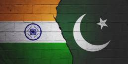
Happy Independence Day India
We wish all Indian people around the world especially those here in…

Happy Independence Day Pakistan
We wish all Pakistani people around the world especially those here in…